How to do a land survey
This is another part of the series about the land survey we did on the farm before purchasing it.
A land survey is a physical activity. The surveyer has to walk the limits of the land, mark points on the ground and get their coordinates. With that information he can then create a property map. In Panama these property maps have to show GPS coordinates for all points using the UTM coordinate system.
Our surveyer uses equipment from Trimble. In the backpack he carries batteries to power the handheld computer and the GPS receiver. The white thing on the top of the telescopic pole is the GPS antenna.
<div style="text-align:center;">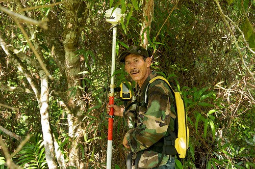 </div>
Our surveyer is called “grillo”. That’s Spanish for cicada. And look what he has painted on the back of his T-Shirt:
<div style="text-align:center;">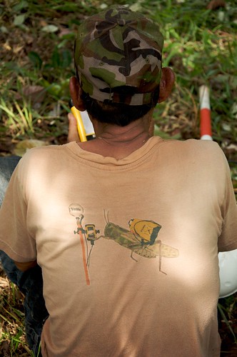 </div>
Doing a land survey means walking. Lots of walking. During the survey of the farm “grillo” marked 87 points. It took 3 days and it might have taken longer, if the terrain were more difficult.
<div style="text-align:center;">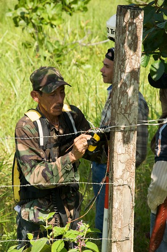 </div>
With each point step by step a map gets drawn on the display of the handheld computer. After the line gets closed and the full polygon exists the physical part of the survey is done. Then the actual propery map is created in the office and printed on large format paper.
<div style="text-align:center;">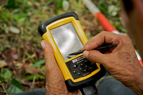 </div>
After our three days survey we had to wait for another day and got presented the map in the picture. The farm is actually much larger than what the map shows. Due to the cost of such a survey we did measure only the part where it has pasture. That part turned out to be 128 ha and a few square meters. We estimate the other part which is virgin rainforest to be an additional 200 ha.
<div style="text-align:center;">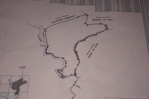 </div>
The blue line is the river that borders the farm. You can see all the 87 points forming the polygon. To the south our “servidumbre” is shown. That’s an important detail.
You need road access to get to your land. So there is a law that you cannot title land without an access road agreed upon by all parties involved. If your property doesn’t border a public road, you will have to negotiate with your neighbors to get their permission to travel over their land. They have to sign on your property map or the map won’t get accepted by “reforma agria”. This is very important. If you aquire Rights of Possession in Panama and forget to have your neighbors to grant you right of way in writing, you may end up unable to access your land. There is usually more than one neighbor and you can’t force anybody to grant you right of way. If they are reluctant to grant you that right, you will have to negotiate with all of them until one is willing to let you through. That may be a long process and in the end you will have to pay for the right of way.
The best way to solve these issues ahead of time is to become friends with your neighbors. You have to be there, talk to them, maybe employ their services for something and simply be a nice guy.
| Previous | 24 Oct 2009 | Next |


About me
Hello! My name is Stephan Schwab.

I build and rescue software, and I write fiction about the human side of how it gets made. Here you’ll find my stories and novelas, notes on craft, and field notes from a life lived across several worlds.
Working with software teams is what I do professionally — see how on caimito.net. You can also read about my experience since 1986.