The last 300 meters
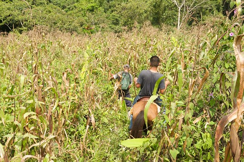
This time we were extremely lucky. We found the peon who is the owner of the maiz field that was blocking our way the last time. His maiz is due for harvesting and offered to open up a path through it with his machete. Of course the horses took advantage of the situation and snapped up some of the corn. You could clearly see they were quite happy.
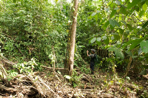
At the lower end of the maiz field there is a little creek and there where he points to is the path.
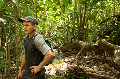
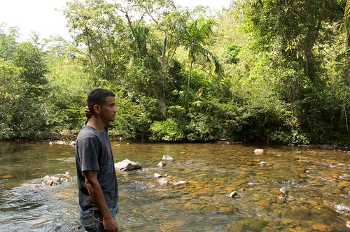
Here is a nice picture of this young fellow. I would tell you his name now but unfortunately we lost the piece of paper where we wrote it down. So before I tell you something wrong, let’s wait until we have a chance to talk to him again. Won’t be long. I can still tell a bit about this guy. He is from the Darien province which is the place that borders Colombia, full of virgin rainforest and is called as well the Darien gap due to the fact that the Interamerican Highway from Alaska to Punto de Fuego at the tip of South America is missing about 200 km here in Panama. His father sold a strip of land in Darien and bought another in a remote place there in Canitas and so the family moved. He lives at the end of a dirt road with three rivers crossings at a place called Playita. That translates to “little beach” but there is no beach anywhere near it ;-) There he lives in a hut with his wife and little daughter. Actually he asked us whether we need a permanent peon on the farm as he wants to live closer to the village where the school is. From Playita to the village it is about 4 hours on horseback and there is no school. Once we start we may employ him. He seems to be a nice guy with some experience. Plus people from those very remote areas are usually hard workers simply because there is no other way to survive. I’m sure I will tell more about him soon.
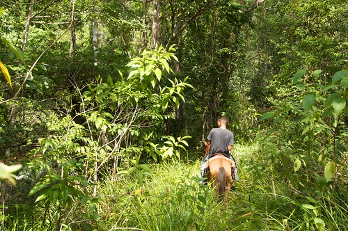
Here Luis is riding in the middle of the last few meters of the path towards the river. We were so close that we could hear the sound made by the water. As you can see that path is wide and there is nothing to do to drive the Jeep through it. Almost a highway ;-)
We’ve reached out destination. Left of Luis you can see a few rocks on the other side. That’s where the path leaves the river.
Here is an enlarged picture of that section:
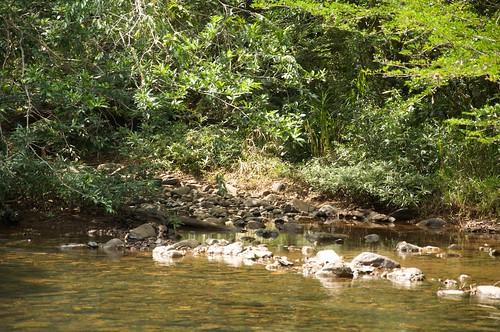
The river is very shallow. It is kind of a natural river crossing. Of course we are in the dry season now and there isn’t much water but even with water levels rising I think this is still a useable river crossing most of the time. The bottom of the river is all rocks and slightly elevated so even with more water we should be able to cross it. The river is wide there as well which hopefully makes the water flow slow and hence the force of the water won’t we too much.
Crossing a river with a 4WD vehicle is usually not a matter of how deep you can wade. The issue is the force of the water. If you have big tires and your air intake is very high, then you can go in up to the doors or higher but that doesn’t help much, if the water pushes you down the river and you don’t have enough power or traction to push against that massive force.
Still this river crossing looks far nicer than the official one on the road from Buenos Aires to Playita that we used to cross all the time before.
All we need now is the confirmation of my rights of possession to the farm on the other side and then we can start. See next post about the legal issues.
| Previous | 28 Jan 2010 | Next |


About me
Hello! My name is Stephan Schwab.

I build and rescue software, and I write fiction about the human side of how it gets made. Here you’ll find my stories and novelas, notes on craft, and field notes from a life lived across several worlds.
Working with software teams is what I do professionally — see how on caimito.net. You can also read about my experience since 1986.