Meeting with the district administrator to complete the road
During our recent meeting with the administrator of the Chepo district we looked at the river crossing and also at ways to avoid a quebrada - a little creek - that caused far too much erosion to the dirt road that was created about 2 or 3 years ago.
The district administrator owns a strip of land himself and to access it he had invested into building a dirt road. This road crosses over the land of four other farmers.
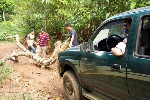
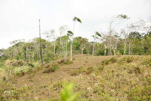
The following picture shows the existing road after the quebrada. That obstacle is hidden behind the bushes and below the place from where I took the picture. The road makes a right turn to enter the forest again and finally connect to the road we are currently building.
Our party went up a little hill to checkout a alternative path.
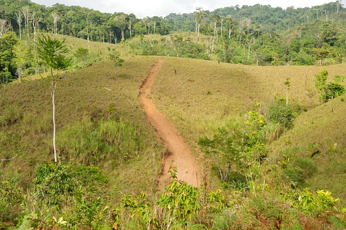
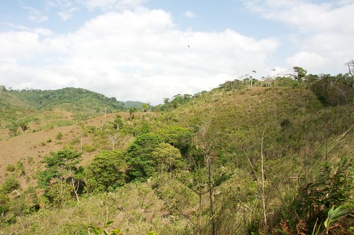
Soon we arrived at the end of the path a bulldozer had created and looked at the trail ahead. It does look very promising. We think that we don’t have to drive heavy equipment through the jungle to establish an access road. If we choose the right path on top of a ridge then the road will kind of establish itself just by using it. It is not our intention to build a paved road anytime soon. We are just looking for something like a better trail to get through with the Jeep.
That trail needs a bit of cleaning left and right which is easily done with a machete. What lies ahead is already open.
The trail makes a long turn from the right of the picture to the center and then goes right to cross an open field where it will then enter the forest in the background. We’ve been there before on horseback. The trail is wide enough for the Jeep and only minor work is required. There are some fallen trees and some brushwood but that’s about it.
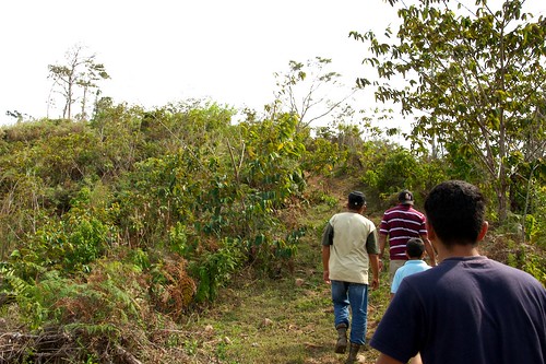
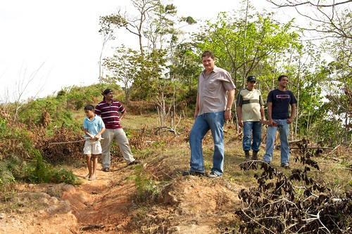
Here is a picture of our party with the district administrator Olmedo Barrios in the center.
People were talking about a shorter path by cutting through the forest which can be seen in the very background (look at the center of the picture above). That forest belongs to our farm. We are going to explore that - just in case - although I have some doubts whether that might be a better route.
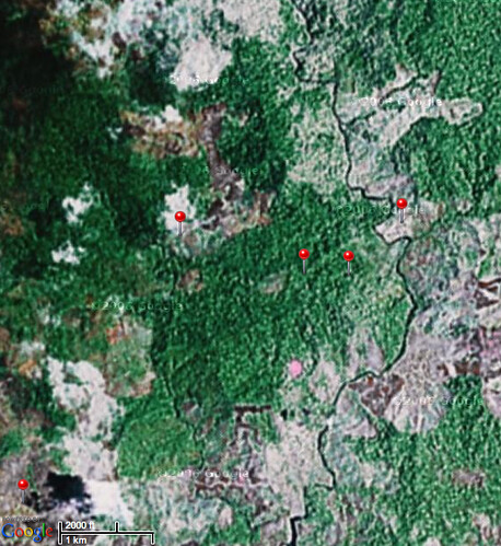
Here is an image from Google Earth with red pins marking some locations. Let me explain:
The pin in the lower left corner is the village of Buenos Aires. From there go straight up and a bit to the right to find another red pin. That’s where we looked at the trail you see in the pictures above. The crossing over the river is a bit to the west from there. The red pins to the east mark the trail through the forest that we are currently opening up. Go further to the east and you’ll see a dark line which is the Chuluganti river and the pin next to it is where the farm is located. The farm is all the white area from there to the north.
The suggestion has been to cut straight instead of making a long winding road. That would lead us directly to the farm but unfortunately the river has some very steep banks left and right further upstream. That’s why I have some doubts.
| Previous | 18 Feb 2010 | Next |
This article has been posted to social media sites. There might be comments. Just follow the links:

About me
Hello! My name is Stephan Schwab.

As International Software Development Coach and Consultant I help CEOs and Department Leaders to improve value creation and cohesion within their organization. The outcome will be higher quality, customer delight and more revenue.
Learn about my professional experience since 1986.
I'm fluent in these human languages:


Special Content
- Developing a farmstead in Andalucia, Spain
- Building a house, Spain
- Business travel with light aircraft
- Horses
- Rainforest Farm, Panama
- Photo Galleries
Highlights of the Year
Living on planet Earth
Open Source Projects
Stay in touch


![]()
![]()
![]()
My Books


Everything
See a listing of all posts on this site.